
Millville ZIP Code Directory Coverage
Official USPS evidence verifies only one standard ZIP for Millville in the material reviewed: 08332. That is not a declaration that every Millville address carrying a Millville mailing line lies within the legal city, and it is not evidence that no surrounding routing code ever appears on mail. The USPS address lookup, used with a complete Millville delivery address, is the source for a returned ZIP, ZIP+4, and preferred mailing city. No other ZIP serving the legal City of Millville was verified from an official address-level USPS source.
| ZIP | Areas Covered | Post Office | Notes |
|---|---|---|---|
| 08332 | Millville postal place and addresses accepted by the USPS address-level lookup | Millville Post Office, 302 High Street North | Verified standard ZIP. Exact ZIP+4, preferred city, neighborhood coverage, and legal municipality require an address lookup and parcel check. |
The USPS Millville Post Office listing is the source for the local office and its 08332 address.
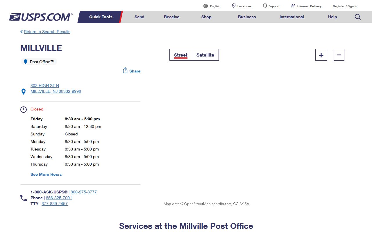
The listing verifies the Millville postal facility, not a complete boundary map or resident roster. Millville delivery details remain address-specific.
Confirm a Millville Postal Address
The USPS address-level lookup is the only verified route here for a Millville ZIP result. Submit the complete Millville address rather than trying to derive a delivery code from a street segment, municipality name, census boundary, or neighboring post-office route. The postal result resolves Millville mail-delivery information, while the assessor and GIS resolve parcel and local-geography questions.
| Search mode or control | What it supplies | Limit for Millville research |
|---|---|---|
| USPS exact address lookup | Returned ZIP, ZIP+4, and preferred mailing city for the submitted address | Delivery result, not a legal-city boundary or household list |
| Millville assessment Location search | Address-oriented parcel and assessment route | No visible ZIP field; it does not produce a ZIP-wide set |
| Cumberland GIS map | Parcel, road, zoning, and boundary context | No visible ZIP search field in the text capture |
| New Jersey voter status tool | Individual registration-status workflow | Live fields were not captured; it is not a ZIP-wide search |
| Census address or data tools | Address plus city/state or ZIP data context | ZCTA geography is not a USPS ZIP boundary |
Enter a Millville address exactly as known. If USPS corrects a directional, street type, ZIP+4, or preferred city, retain that result as a delivery finding and compare it with the Millville parcel record rather than overwriting the legal address.
Use a Millville ZIP Search Path
A Millville ZIP narrows Millville delivery geography, but the official local tools reviewed do not offer a ZIP-wide resident search. The assessment form uses Location, Owner Name, Block, Lot, and Qualifier. GIS offers parcel and road context. The public voter status tool is an individual workflow. Use each Millville source for its documented task, then move to an address or parcel rather than assuming a postal code can return every person or property within it.
- Run the complete Millville address through USPS and save the returned ZIP, ZIP+4, and preferred mailing city.
- Use the Millville assessment Location field to find the parcel-level record, then note block, lot, qualifier, and any displayed situs or mailing labels.
- Open the Cumberland GIS viewer to compare the Millville parcel, road, zoning, and municipal-boundary context, without treating the map as a ZIP layer.
- When the question turns on a named street or a recorded owner, continue with the address and parcel trail rather than trying to create a ZIP list.
Once a postal result is narrowed to a specific address, the Millville street directory provides the appropriate assessor, GIS, deed, and historical-address sequence.
Millville ZIP and City Limits
Millville ZIP results and Millville legal city limits describe different geographies. Postal codes are delivery geographies. A Millville city line is a municipal boundary. A parcel’s situs and legal description identify the land relationship. A tax mailing address identifies where correspondence goes. Those values can agree, but they do not have to. The city’s modern borders meet Deerfield, Lawrence, Downe, Commercial, Maurice River, and Vineland, so a Millville city-name search should retain both Cumberland County and the municipality.
No official address-by-address mismatch list, enclave map, or verified edge-address examples were located in the research. No nearby routing ZIP should be listed as a Millville city ZIP without an official USPS address-level result. Similarly, an address using a Millville preferred mailing city cannot be treated as proof that the parcel lies inside the City of Millville.
Boundary check. Use USPS for delivery, the assessor and GIS for parcel context, and the legal description for recorded land. Keep each Millville result labeled by its source and date.
Define Millville Postal Terms
Postal terms can look like Millville land-record terms, but they serve different purposes. Millville searches become more accurate when the result is named correctly before it is compared with a Millville parcel, deed, or city-limit record. The definitions below preserve that distinction and prevent a delivery label from being treated as a legal description.
- ZIP
- A USPS delivery code assigned to an address or postal area. It is not a municipal boundary.
- ZIP+4
- An added four-digit delivery detail returned for a specific address; confirm it with the USPS address lookup.
- PO-box ZIP
- A postal code used for post-office boxes, which does not by itself identify a physical delivery address.
- Unique ZIP
- A code used for a single institution or organization. No Millville unique ZIP was confirmed in the reviewed official material.
- Carrier route
- A delivery-routing grouping used by USPS operations, not a city district or a household roster.
Census ZCTAs are another separate category. They are generalized statistical areas and should not be substituted for USPS delivery boundaries in Millville address research.
Millville Parcel Maps Have No ZIP Field
The Cumberland County GIS viewer is valuable for Millville parcel geometry, streets, boundaries, zoning, land use, soils, and preserved land. Its text-accessible description did not show a ZIP search field. The live viewer’s parcel-popup fields and mechanics were also not captured. Use it to locate a road and parcel relationship after USPS verifies delivery, then confirm ownership or mailing information elsewhere.
The Millville assessment search form likewise displays Location, Owner Name, Block, Lot, and Qualifier rather than a ZIP control.
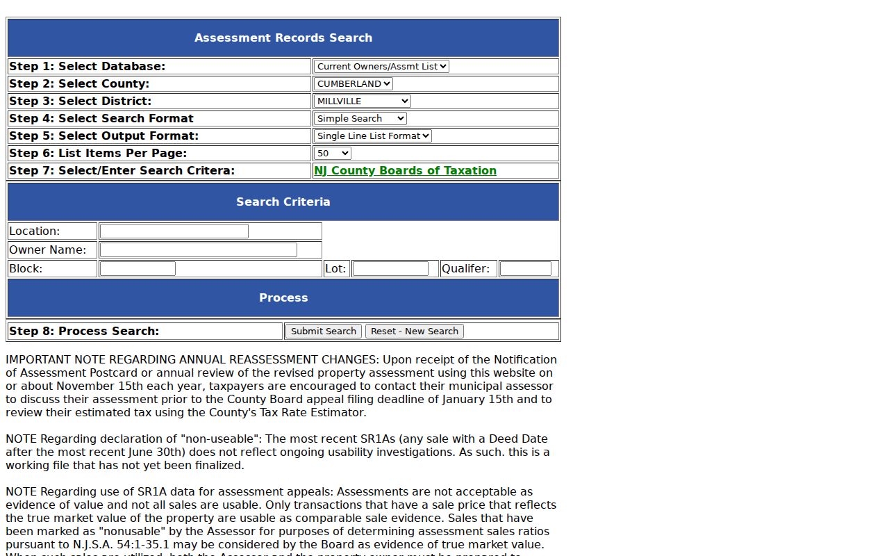
The form supports parcel and address work after postal verification. It does not establish a ZIP-wide property or resident inventory.
Bridge Millville ZIP to Parcels
After USPS returns a Millville delivery result, preserve the full Millville address, returned postal values, and preferred city. Then find the property in the assessment search and use block, lot, and qualifier to bridge to the GIS parcel, tax map, or deed legal description. A Millville street address can change while a block and lot remain stable. Conversely, a subdivision, condominium qualifier, parcel split, or merger can change how the street address relates to a parcel.
Millville historical records add another layer. A legal description may use metes-and-bounds language, and an older directory may use a former street label or different postal wording. City Park Drive, between North Brandriff and West Main, was renamed Martin Luther King Jr. Drive. Preserve old and new names alongside the postal result, but do not assume that the rename changed delivery boundaries.
Note: USPS, parcel, and historical-address results should be retained as separate evidence rather than merged into one label.
Millville ZIP History Is Unconfirmed
No official Millville ZIP split, realignment, or local postal-boundary timeline was located. The research also did not confirm a PO-box-only ZIP or unique ZIP for Millville. That Millville absence is important: it prevents a precise-sounding history from being invented out of nearby routing references or census maps. A future verification would need dated USPS material and representative address-level tests paired with legal parcel checks.
Millville’s record geography changed in other ways. The city organized as a township in 1801 and incorporated in 1866. County records route through Cumberland County and its county seat in Bridgeton, while the county GIS office is physically in Millville. Those facts explain where records are kept, but they do not establish a postal realignment or a complete list of delivery areas.
Millville ZIP Research Limits
A Millville postal reference is an address-verification tool, not a resident directory by postal code. The official tools reviewed do not show a ZIP field on the assessment form or GIS page, and the voter status path is not a ZIP search. Census geography should be labeled as ZCTA or data context. A complete or current list of people, households, owners, or voters cannot be inferred from a delivery code.
Millville address work must also respect protected and limited records. New Jersey’s Address Confidentiality Program can provide a substitute address for eligible participants. A public record should not be combined with a postal lookup to reconstruct a suppressed location. Ask the appropriate custodian for a specific, legally releasable record and keep delivery, parcel, and legal-municipality findings separate.